 |
||||||
New! Photo Galleries |
New! Forums |
New! Classifieds |
New! Calendars |
New! Local Links | ||
|
||||||
New! Photo Galleries |
New! Forums |
New! Classifieds |
New! Calendars |
New! Local Links | ||
|

|
|
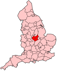
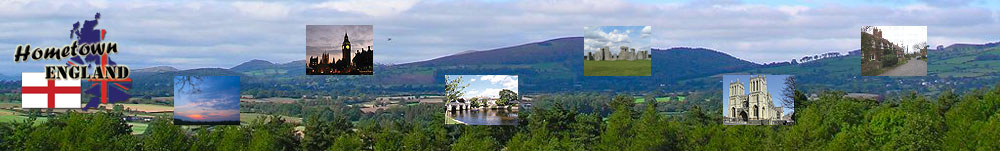
Leicestershire
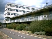
Leicestershire (abbreviated Leics) is a landlocked county in central England. It takes its name from the heavily populated City of Leicester: traditionally its administrative centre, although the City of Leicester unitary authority is today administered separately from the rest of Leicestershire. The county borders onto Lincolnshire, Rutland, Northamptonshire, Warwickshire, Staffordshire, Derbyshire, and Nottinghamshire. County Hall, situated in Glenfield, about 5 km (3 miles) northwest of Leicester city centre, is the seat of Leicestershire County Council and the headquarters of the county authority. The City of Leicester is administered from offices in Leicester itself and the City Council meets at Leicester Town Hall. The River Soar rises
to the east of Hinckley, in
the far south of the county, and flows northward through Leicester
before emptying into the River Trent at the point where Derbyshire,
Leicestershire, and Nottinghamshire
meet. A large part of the northwest of the county, around Coalville,
forms part of the new National Forest area extending into Derbyshire
and Staffordshire. The highest point of the
county is Bardon Hill at 278m/912ft, which is also a Marilyn.
History
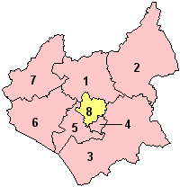
Leicestershire's external boundaries have changed little since the Domesday Survey. The Measham-Donisthorpe exclave of Derbyshire has been exchanged for the Netherseal/Overseall area, and the urban expansion of Market Harborough has caused Little Bowden, previously in Northamptonshire to be annexed. In 1974, the Local Government Act 1972 abolished the county borough status of Leicester city and the county status of neighbouring Rutland, converting both to administrative districts of Leicestershire. These actions were reversed on 1 April 1996, when Rutland and the City of Leicester became unitary authorities. DemographicsThe population of Leicestershire (excluding the city of Leicester) is 609,579 (2001). The county covers an area of 2,084 sq km (804 sq mi). The largest population
centre is Leicester, followed
by Loughborough. Other
major towns include Ashby-de-la-Zouch,
Coalville, Hinckley,
Market Harborough,
Melton Mowbray, Oadby
and Wigston. Places of interest
The above article
in gray is licensed under the GNU
Free Documentation License.
|
|||||||||||||||||||||||||||||||
Our hometown sites offer: Yellow Pages, Classified Ads, Guestbooks & Forums, Community Calendars, History and Trivia.
These Community Websites are part of a network of over 11,000 represented within the Hometown England Network of Communities. We rely upon and encourage all members of the community to participate in the development of these pages. So come on in and visit with us, see what our great communities have to offer and if you can't find what you are looking for, let us know by posting a question in our Community Forums so that a member of that hometown can reply to you or email you the answer.